ZULUUTC / Z
—UTC+00
Saved on this browser. Shared with your TV when you cast.
READ ONLY Independent radio monitoring · Source timestamps shown · Approximate node positions
PHRYKTOR / LIVE WORKSPACE
Your radio, reports, and services at a glance.
Most recent message from each radio channel (private messages excluded).
Feed timestamps reflect each source’s collection schedule.
Radio acceptance confirms local submission, not remote reception.
CPU and memory are sampled every 30 seconds. Network and disk I/O are cumulative counters.
| Container / image | State | CPU | Memory | Network I/O | Started | Restarts |
|---|
Loading your mesh…
All nodes come from contacts stored on this radio. Positions and timestamps are from advertisements, which may be old or relayed. The sampled RF packet view records reception at this radio; it does not provide statewide coverage or prove direct links.
Dedicated USB observer health updates approximately every 30 seconds. The reporting radio operates separately. Counters are cumulative since the observer restarted.
Saved radio contacts, not a list of currently online devices. Routes describe the radio’s stored outgoing path; they do not prove direct reception.
| Contact | Type | Last advertisement | Stored route |
|---|
This legacy sample list may contain older observations. Use Packet explorer for the current 30-day archive. Private message contents are never displayed.
| Received | Packet type | RSSI | SNR | Bytes | Path |
|---|
| Requester | Command | Time | Request | Response |
|---|
Source: messages dequeued from this radio by Phryktor’s local listener. No Discord, external mesh website or MQTT inbox feed is used. Public view excludes DMs.
Latest 200 received events. Use Room messages for the full 30-day public archive.
Latest archived content for each topic. Original timestamps show how recently a report was recorded. Public snapshots refresh every minute.
WEATHER DESK / AURORA & FRONT RANGE
Plan with the forecast. Track precipitation with observed radar. Check official warnings for affected areas.
CURRENT · follows latest observation
Observed precipitation echoes from NOAA/NWS MRMS. Coverage and reporting delays vary; a blank map does not prove clear weather. Current mode checks every minute and follows the latest actual NOAA observation. Replay keeps your chosen frame. High quality uses larger images with categorical colors preserved; it does not increase the source’s physical resolution. Longer loops use saved Colorado frames, retaining up to 24 hours and building history over time.
Loading observations…
Use official flood outlooks and river forecasts, U.S. Drought Monitor Colorado, and burn-scar flood guidance alongside these observations.
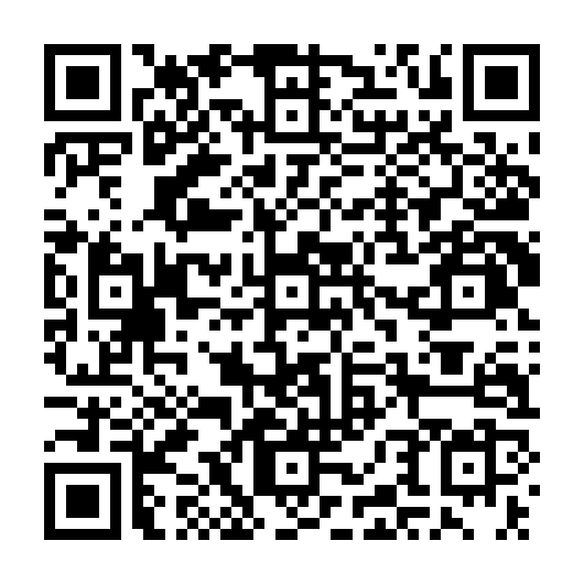
Connect your companion radio, then scan this code with the MeshCore app to add the room.
On the same phone? Tap Add room in MeshCore. If your camera does not open the app, use its channel QR scanner. You can also add the hashtag #phryktor manually.
This is a public hashtag room. Adding it does not change your radio settings or share your location.
OPERATIONS / FRONT RANGE
Choose a city, ZIP area, or point on the map. Saved places and routes stay in this browser.
Loading local sources…
Map: warnings · road incidents · cameras · air monitors · fires · reported storm impacts · official emergency areas. Click any point to focus there.
Updates are grouped by source and incident ID. Collection disappearance and alert expiry do not confirm resolution.
Read public radio observations → Radio conversations remain separately attributed; they are not treated as official incident confirmations.
SITUATIONAL AWARENESS / COLORADO
Choose your area, turn individual layers on or off, and select a basemap. Your choices are saved in this browser.
Mesh positions are approximate; markers do not show coverage or guaranteed connectivity. Radar shows observed echoes. Smoke is model guidance, not a ground measurement. Fire markers show reported incident locations, not evacuation boundaries. Weather markers show warnings and urgent severe threats; watches and advisories remain in the full alert list. Icons label official alert areas, not exact tornado or lightning locations. No individual lightning-strike feed is connected. Alerts without polygons remain in the alert list.
EPA AirNow preliminary AQI for ozone and particles, whichever is highest at each monitor. PM2.5 concentration is in µg/m³. Readings vary by location and can be revised.
Samples are recorded every five minutes. Gaps mean no observation; they are not counted as healthy or failed. Packet counts are differences between continuous radio samples and are unknown after counter resets. Signal values describe the last received sample, not every node. Recently heard means reported within 15 minutes, not a guaranteed reachable node.
Phryktor combines local radio observations with attributed public sources. Use the master overview for your chosen city, monitoring for data freshness, and source links for official details.
Phryktor: reports and general commands. Wire: Wire reports. #weather: standalone concise NWS forecasts (wx or wx ZIP), weather full and point-specific alerts; separate from Phryktor reports. #bot: ping, test, sig, path, version, hello, joke, dadjoke, dice, roll, coin and magic8. Public, #emergency and other community rooms are observation-only. Direct messages support reports and bot utilities.
help in a supported channel, or send help directly to Phryktor.wx 80018, roads I-70, or sitrep brief. Wait for the radio response before repeating a request.This website only displays information. The commands below must be sent from your radio app.
The #wirereports channel supports wire, latest, since 3w, and wire YYYY-MM-DD. Requests are limited to one full report with a five-minute cooldown.
Use official alerts and local instructions for emergency decisions. This dashboard is a supplemental community information service.
Saved only in this browser. No account and no changes to the radio or server.
Essential conditions, alerts, road summaries and network status. No map tiles, radar images, or large archives.
Open lightweight view ↗Rotate Right now, Situation map, Radar, and Network history with your clock selection.
Download a timestamped HTML briefing to save, share, or open and print to PDF. It includes the information currently available, with source ages.
PHRYKTOR / OPEN SOURCE INTELLIGENCE
Official releases, world reporting, investigations, and public social posts. Follow each item to its original source.
Loading source feeds…
Official statements describe the issuing organization’s position; social posts and news claims are not independently verified by Phryktor. Region tags use headline keywords. Repeated links do not count as independent confirmation.
Free public feeds · checked every 10 minutes · original publication times preserved · source links open externally. Daily briefs are automatically selected headlines, not analyst assessments. No private messages or account credentials are published.
LOCAL RF / 1090 MHz
Aircraft heard by Phryktor’s own antenna, with live positions and recorded flight trails. This map can be used on its own; choose which aircraft types and colors to display.
Aircraft icons & colors: customize by type above— Recent trail · 15 minFaded: last heard over 30 sec ago
AIRCRAFT DETAILS
Choose a marker or a row below to inspect its received flight data.
| Aircraft | Type | Altitude | Speed | Heading | Last heard | Position |
|---|
FLIGHT HISTORY / 90 DAYS
Five-second samples, saved on the external drive. Choose a UTC hour to explore its flight trails. History starts when this receiver was connected.
Loading archive index…
Source: local RTL-SDR Blog V4, decoded with readsb. Aircraft models and military flags use a locally installed tar1090-db / Mictronics identity reference; it supplies no live flight positions. Categories and operator hints are identified in aircraft details. Signals are collected locally. Only aircraft signals received here appear; reception depends on antenna placement and radio coverage. This receiver listens on 1090 MHz, not 978 MHz UAT. Altitudes are transmitted barometric feet unless unavailable; tracks are degrees true and speed is knots. Gaps in trails indicate missing reception. This display is for situational awareness, not aviation navigation.
FRONT RANGE / SEVEN-DAY OUTLOOK
Choose a city for morning, afternoon and evening/night forecasts. Icons show every supplied condition change, alongside the original forecast text.
Loading weekly forecasts…
NWS forecast for each city center. The current day may be partial. Rain/snow chance is the highest supplied period probability for that day. Morning is 6 AM–noon, afternoon noon–6 PM, and evening/night 6 PM–6 AM in Denver time. Hourly temperature ranges and condition changes use supplied NWS forecasts; missing hours are not filled in. Broader day/night fallback periods are labeled. Forecast values are not live measurements.
Official NWS forecast →Loading source data…
Loading source data…
Loading source data…
Public COtrip cameras across Colorado, with saved favorites and available live streams.
Cameras along Colorado mountain corridors, with available live streams.
Streamflow, gauge heights, and observed changes.
Particle pollution trends, regional model guidance, and official smoke outlooks.
Reporting and passive reception use separate radios. Confirmation means the collector recently checked the equipment; it does not prove coverage everywhere.
Collection health and source freshness are different. A working collector can receive old data or encounter an unavailable upstream service.
Recorded from installation onward. Repair completed means the command finished; verified means the health check passed. Root reboot count appears above.
Observed airport weather, regional earthquakes, and space-weather context. Each item keeps its source timestamp and link.
COtrip operator road reports, route weather guidance, closures and incidents. Live traffic speeds and congestion estimates are not supplied by the connected feeds.
Incident briefings, cameras, source updates, assistance and reviewed community observations in one place.
Select an incident to see its briefing.
Updates cover your selected area, saved places and followed road routes. Browser notifications work while this site is open; they do not provide closed-browser push or replace official alert subscriptions.
Official finders remain authoritative. Operator-entered entries include a source, observation time and expiry; they do not imply complete coverage.
Approved reports are reviewed for publication, not independently verified. Send neighborhood-level observations; avoid names, exact home addresses and private information. This form does not contact emergency services.
Each timeline follows versions of the same agency/source record. Nearby reports are context, not automatically the same incident. A record disappearing or expiring does not prove resolution.
Current means the collector recently succeeded; it does not guarantee every measurement is recent or complete. Original observation times remain visible. Delayed or unavailable data is not an all-clear.
Pin cameras for a 2, 4, 9 or 16 view display. Select which pinned cameras run live video. Preferences and clock settings stay in this browser. Live feeds use this viewing device’s bandwidth; some cameras offer snapshots only.
Official COtrip imagery · streams have independent delays; shared refresh does not synchronize source capture times · snapshot timestamps are shown when supplied. Fullscreen applies to this display; Escape exits.
Public messages actually heard or accepted by your local radios. This view reads the archive; it does not send messages or expose private conversations.
Open #emergency · Open #cm-reach · MECP decoder & code reference
MECP messages are translated below their original text. Reports are unverified; tests and drills are labeled. No emergency acknowledgements are sent.
Checked against Colorado Mesh’s published common-channel directory on October 4, 2026. These channels are already included in Phryktor’s monitored room list; a room may have no locally received messages.
Official community channel guide · Public is the general channel; Phryktor and Wire are additional existing local rooms.
MHC means Mesh Health Check. A message such as MHC- followed by six hexadecimal digits identifies a reach-test session. People send it to find out which participating receivers hear their message. The digits are random; they do not translate into an emergency, location, route or signal strength.
Below each recorded code, this reader explains its purpose and shows matching local chat entries. Broader results require the test service’s actual observer receipts; they are not embedded in the code. This reader uses only Phryktor’s locally collected public messages.
Protocol / reach-check project documentation · Official Colorado Mesh Range Check · opens separately. Phryktor does not load its API, observer feed or session results.
Loading locally heard messages…
New messages appear at the bottom · source reception time shown.
Actual recorded snapshots, starting when recording is enabled. Up to 48 hours within a shared 256 MiB limit. Source gaps remain gaps; past video cannot be reconstructed.
Follow any road in the statewide camera catalog. Narrow it to a corridor using map points, then see nearby cameras, reported conditions, weather and dated hazard context. Drawn corridors are planning references, not turn-by-turn directions or verified open roads.
Cycle between the situation map, pinned camera wall, incident desk, tagged mesh room and route watch. Configure those views first; saved preferences are used. Start rotation is a user action, and Escape stops it.
Dated USGS post-fire debris-flow assessments under specified rainfall scenarios. These are model assessments—not current warnings, active debris flows, evacuation areas or assurances of safe travel.
Actual snapshots preserved near new or changed official weather, fire and closure notices. Notices may describe scheduled work; nearby images do not establish that an incident is visible. Recording starts when a notice is detected, with existing pre-trigger frames only when already recorded.
Coarse cells show collected route activity and available source records. This is not an RF range prediction or proof of message delivery. Receiver and Phryktor positions remain hidden. Gray cells indicate no collected record—not no signal, no station or safe conditions.
Cell sizes are 0.25°; counts use approximate public positions. Mesh counts associate received route metadata with uniquely matched advertised nodes. No circles or connecting paths are inferred around receivers.
Download a PDF with your configured situation map, chosen collected notices, actual camera snapshots and their source timestamps. The PDF is generated in this browser. Visible planning notes can appear in the map image.
Configure the situation map and pin cameras first, or choose cameras below. Select up to 10 notices and 6 snapshots. Historical map replay and current camera/report sections are labeled separately.
Missing images, map layers or source data are listed in the PDF; no replacements are fabricated. Generation may briefly show the situation map. Map tiles retain provider attribution.
Local headlines and official updates collected by FreshRSS. Reporting is not independently verified; open the publisher for the complete story.
Select sources below. National and world news are optional. Your selections and bookmarks stay on this browser; no account is needed.
Loading collected headlines…
Feeds checked every 15 minutes; this reader refreshes every 5 minutes. Empty official-alert feeds can mean no active notices. Publication times come from each publisher. Powered by FreshRSS · open source
START HERE
Start with the map, then choose a page for more detail. Use Reading settings to change the theme, text size and map labels. This guide includes real screenshots and steps you can follow.
Check the source and its timestamp before relying on a report. A blank view means no collected data, not an all-clear. Public radio messages are read only; the map shows observations heard by our receivers, rather than confirmed delivery at every node.
Your camera favorites, layout and display settings stay in this browser. Clearing browser storage resets them; another phone or computer has its own choices. Private administration, passwords, radio keys and receiver coordinates are excluded from the public site.
No features match. Try a page name or clear the search.
START SMALL · HELP THE COMMUNITY
A MeshCore radio lets your phone exchange short messages over LoRa without mobile data. Start with one companion radio. Add a repeater or an observer when you are ready.
Connect your companion radio, then scan this code with the MeshCore app to add the room.
On the same phone? Tap Add room in MeshCore. If your camera does not open the app, use its channel QR scanner. You can also add the hashtag #phryktor manually.
This is a public hashtag room. Adding it does not change your radio settings or share your location.
Best if you are comfortable assembling a board, antenna, battery and case. Buy the US-compatible 915 MHz version and the correct antenna. A board alone is not a weatherproof outdoor node.
Manufacturer specification & buying optionsAn enclosed nRF52840 handheld with battery and antenna. Confirm the exact hardware is supported in the MeshCore flasher. Some units arrive with Meshtastic firmware; they need matching MeshCore companion firmware to join this mesh.
Manufacturer instructionsA ready companion plus a solar repeater is a simpler outdoor starting point. Check the regional radio variant, mounting, sun exposure and local network settings before ordering.
Manufacturer kit · Solar setup guide#phryktor. Use the app’s hashtag channel option. The network page shows messages actually heard by this system; silence does not prove nobody received your message.Companion: connects your phone to the radio. Repeater: forwards compatible mesh traffic; good height, power and antenna placement matter more than frequent advertisements. Observer: listens and records packets for a map; it is not a repeater or a guarantee of delivery.
Help a neighbor set up a companion, place a well-powered repeater where it improves coverage, keep batteries and solar panels maintained, and contribute a receive-only observer. Obtain permission for mounting and do not publish other people’s private conversations or precise home locations.
Use a spare supported LoRa radio and an always-on computer or Pi. Your observer listens locally and sends only packet metadata to PhryktorNET. Uploads are authenticated, checked, and held for the owner’s review by default.
Maximum 128 KiB; 1–250 recent observations. Credentials are never saved in browser storage.